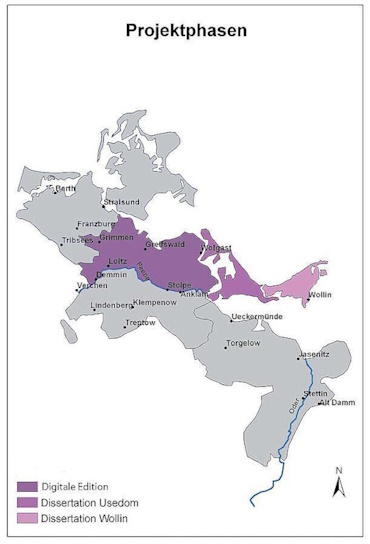
Since 1 January 2008, the former Multimedia and Data Processing in the Humanities department at the University of Rostock has been working on the DFG-funded project ‘Maps and Texts of the Swedish Land Survey of Pomerania 1692-1709. A GIS-supported selection edition of the first German cadastre on the Internet’ under the direction of Prof. Dr Stefan Kroll and in cooperation with geographers, computer scientists and nordists from Greifswald. The edited source material consists of the maps and texts produced in the Swedish survey of the Swedish part of Pomerania north of the River Peene during the years 1692-1709. The surveying and description of each individual village and the associated village boundaries as well as the land and houses of the larger towns was undertaken in order to obtain an exact assessment basis for taxation.
Considered to be one of the earliest German cadastral surveys, it represents a unique component of Germany's cultural heritage and is also of great importance in international comparison, especially as it is almost completely preserved. The project, which was funded over four years, has prepared a relevant part (around a quarter) of the total of 1,500 maps and approx. 23,500 pages of descriptive texts from the Swedish land survey of Pomerania north of the Peene in a digital, scientific edition consisting of various components and made it permanently available to researchers via the Internet. These include high-resolution digital copies, transcriptions and translations from the older New Swedish into German as well as a Geographical Information System - GIS. The digital edition has since been utilised by various research projects. Since 2021, these have included the international linguistic research project ‘Swedifying the other’, which is based at Uppsala University (Sweden) and in which Prof Dr Stefan Kroll is involved as co-investigator.